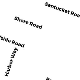
36 SANTUCKET ROAD WD
Owner Information
MALONE JOSEPH S
21 MYRTLE STREET
SAUGUS, MA 01906


Property Details
36 SANTUCKET ROAD WD is classified as a Single Family Residential (Ranch).
The primary structure on this property was built in 1958. There are 728ft2 of built area within this property. There is 728ft2 of residential/living space within this property. This property is listed as having 4 rooms.
36 SANTUCKET ROAD WD is valued at $391,800. The land is valued at $255,900 and the structures are valued at $135,900.
The most recent deed for 36 SANTUCKET ROAD WD is recorded at the local registrar in Book 7834, Page 322. 36 SANTUCKET ROAD WD was last sold on Tuesday, January 14, 1992 for $0.
Assessment data from fiscal year 2022.
Flood Data
According to the FEMA National Flood Hazard Layer, this property does not appear to be in a flood zone. It may also be in an area not yet reviewed. Nonetheless, confirm this information prior to taking any action.
To view the flood hazards around this property, create a FEMA "Firmette" Map of the area around 36 SANTUCKET ROAD WD.
Broadband Internet Providers
| Provider | Type | Bandwidth (mbps) | |
|---|---|---|---|
| Viasat Inc | Satellite | 35 | 3 |
| Verizon New England Inc. | DSL | 7 | 0 |
| Comcast | Cable | 1000 | 35 |
| GCI Communication Corp. | Satellite | 0 | 0 |
| HughesNet | Satellite | 25 | 3 |
| VSAT Systems, LLC. | Satellite | 2 | 1 |
Broadband service provider data from December 2020.
Adjacent Properties
- 159 LORING AVENUE WD
Single Family Residential owned by DONOHUE JOSEPH P TRUSTEE - 155 LORING AVENUE WD
Single Family Residential owned by HICKMAN MARK C ET UX - 32 SANTUCKET ROAD WD
Single Family Residential owned by DUFFY JAMES F - 40 SANTUCKET ROAD WD
Single Family Residential owned by TRUDO GARY S ET UX - 163 LORING AVENUE WD
Single Family Residential owned by LOVEJOY ANTOINETTE V